Narrative Cartography: Walking as a Methodology for Mapping Cultural Memory
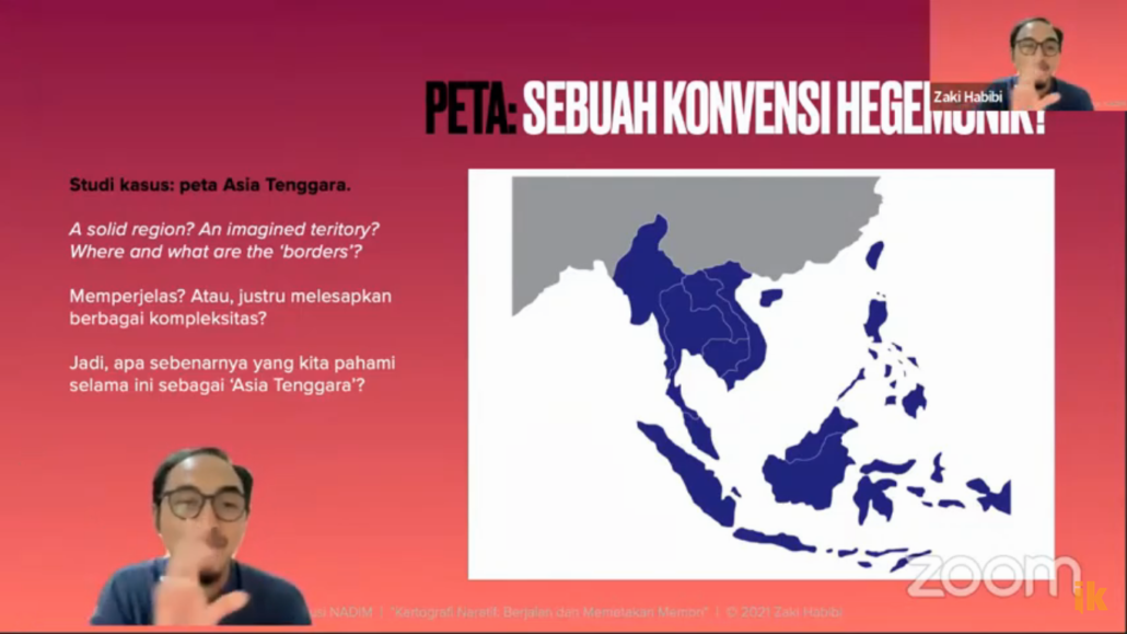
So far, the maps we know are geographical maps: islands, regions, countries, continents, lakes, seas, land. However, if we get acquainted with history, the map may change color. For example, a geopolitical map where certain regions are supporters or opponents of a block or ally at a particular time. Then the map will change because there is a specific war or agreement ten years later.
Zaki Habibi offers a methodology for making new maps of specific cultural memories by walking. Collect, look for memory variations and then describe them in a narrative map. Maps, as a medium for telling stories.
Monthly Discussion Center for Alternative Media Studies and Documentation (PSDMA) NADIM invites Zaki Habibi, a lecturer in Communication Studies at the Islamic University of Indonesia (UII), who recently completed his doctoral studies in Sweden. The discussion on December 3, 021 offered a new method in studying geographic communication and cultural memory: “Narrative Cartography” works as a methodology for mapping cultural memory.”
The idea of this narrative cartography departs from the critique of a single voice and a passion for seeking variety and diversity of cultural meanings for a particular region and culture. So far, the science and science studied are very anthropocentric, in the sense that all knowledge is used to help human interests: technology to facilitate humans, geology for human goods, agriculture to produce human prosperity.
“Well, the perspective that is built will be beyond the human world. This means that humans are not the only ones who live and live in prisons where all things are intended for human life and prosperity. But that humans are one entity related to other entities such as animals, plants, air, soil and other living entities in the ecosystem.”
For example, National boundaries are irrelevant because now there is interconnectedness and networking as citizens of a city. Those concerned with disaster certainly have a different map, or people with environmental concerns certainly have another map. For example, certain areas have certain geographical and geological conditions and potential disasters; they are associated with humans. In the future, it will be possible to map which areas are vulnerable, which areas are safe for settlement, which areas will be suitable for agricultural land, and so on.
So far, the map seems to be holding back. “This map regulates government-to-government relations but does not set creativity. People experience life on the coast. Differently, the north coast and the south coast have different lifestyles, and creativity to overcome various life problems simultaneously have certain similarities, “said Zaki.
Zaki emphasized that the task of a scholar is to be a part of connecting and understanding these differences.